Randonnée Marche Le Hohwald - Hohwald - Rothlach - Neuntelstein - Photo

Hohwald - Rothlach - Neuntelstein

 VacheKiri67
VacheKiri67

Utilisateur

© OpenStreetMap contributors
Longueur
Longueur
15,8 km
Altitude max
Altitude max
981 m
Dénivelé positif
Dénivelé positif
499 m
Km-Effort
Km-Effort  
22 km
Altitude min
Altitude min
567 m
Dénivelé négatif
Dénivelé négatif
499 m
Boucle
Boucle
Oui
Date de création :
2024-05-12 07:51:55.683
Dernière modification :
2024-05-12 15:11:36.571

(0 Avis)

Marche
Marche
4h28
Difficulté : Moyen

Scannez ce code QR pour ouvrir la randonnée dans l'application SityTrail

Application GPS de randonnée GRATUITE

Logo SityTrail SityTrail

IGN / Instituts géographiques

Télécharger SityTrail sur l'App Store Télécharger SityTrail sur Google Play

Logo SityTrail SityTrail World

Le monde est à vous

Télécharger SityTrail sur l'App Store Télécharger SityTrail sur Google Play Télécharger SityTrail sur Huawei AppGallery

À propos

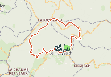
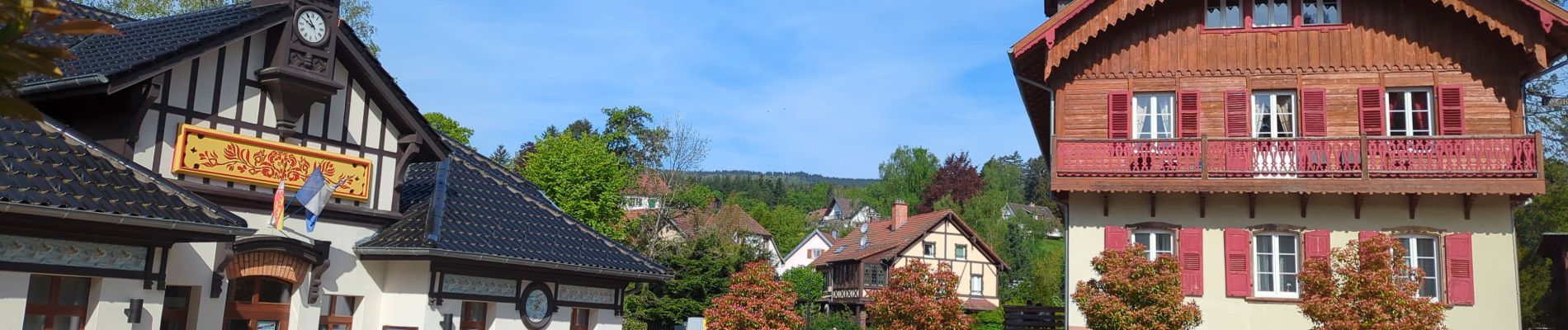
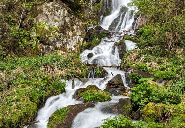
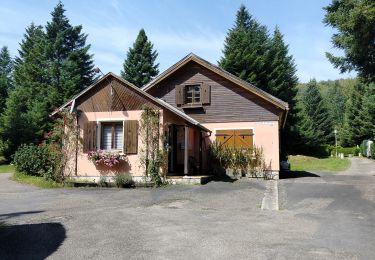
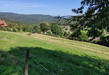
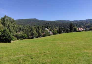
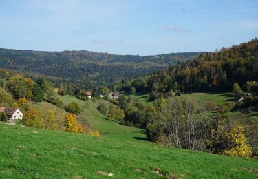
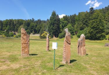
Randonnée Marche de 15,8 km à découvrir à Grand Est, Bas-Rhin, Le Hohwald. Cette randonnée est proposée par VacheKiri67.

Description

Faite le 12/05/2024. D'après le Guide Rother Vosges "25 Hohwald - Rothlach - Neuntelstein". Parking : derrière l'office du tourisme du Hohwald.
Pas de difficulté particulière pour ce parcours dans de belles forêt d'altitude. Idéal pour trouver un peu de fraîcheur lors des journées chaudes.

Profil altimétrique

Photos

Localisation

Pays :
France
Région :
Grand Est
Département/Province :
Bas-Rhin
Commune :
Le Hohwald
Localité :
Unknown
Départ:(UTM)
376381 ; 5362404 (32U) N.

Randonnées à proximité

Randonnée Marche Le Hohwald - 2024-04-27 Marche Cascade du Hohwald Champ du Feu - Photo
Marche
GUIDE
holtzv

Marche

Moyen
Le Hohwald, Grand Est, Bas-Rhin, France
20 km | 31 km-effort
6h 58min
Oui
Randonnée Marche Reichsfeld - 2019-12-28 Marche Reichsfeld Ungersberg Gruckert - Photo
Marche
GUIDE
holtzv

Marche

Très facile
Reichsfeld, Grand Est, Bas-Rhin, France
12,2 km | 20 km-effort
3h 5min
Oui
Randonnée Marche Le Hohwald - Tour du Hohwald - Photo
Marche
zazie

Marche

Moyen
(1)
Le Hohwald, Grand Est, Bas-Rhin, France
8 km | 11,3 km-effort
2h 26min
Oui
Randonnée Marche Ottrott - 2013-12-29 Marche Mt Ste Odile Maennelstein Birkenfels - Photo
Marche
GUIDE
holtzv

Marche

Moyen
(1)
Ottrott, Grand Est, Bas-Rhin, France
10,8 km | 15,4 km-effort
3h 24min
Oui
Randonnée Marche Le Hohwald - le hohwald, boucle
Marche
bemurix

Marche

Facile
Le Hohwald, Grand Est, Bas-Rhin, France
3,4 km | 4,8 km-effort
55min
Oui
Randonnée Marche Le Hohwald - Hohwald (ter) - Photo
Marche
ROPPJP

Marche

Difficile
Le Hohwald, Grand Est, Bas-Rhin, France
11,2 km | 15,6 km-effort
3h 31min
Oui
Randonnée Marche Le Hohwald - Le Hohwald (bis) - Photo
Marche
ROPPJP

Marche

Moyen
Le Hohwald, Grand Est, Bas-Rhin, France
7,9 km | 11,1 km-effort
2h 56min
Non
Randonnée Marche Le Hohwald - Le Hohwald Grande Bellevue Cascade de l'Andlau - Photo
Marche
oscar1

Marche

Facile
Le Hohwald, Grand Est, Bas-Rhin, France
10,4 km | 14,9 km-effort
2h 48min
Oui
Randonnée Marche Le Hohwald - Par les sommets autour du Hohwald - Photo
Marche
VacheKiri67

Marche

Moyen
Le Hohwald, Grand Est, Bas-Rhin, France
15,1 km | 22 km-effort
4h 7min
Oui


Fermer
Mes abonnements